Trekking in Acacus is fast becoming one of the main tour types in the region. To access Acacus one can either fly to Ghat and enter the southern region of Acacus on foot, or drive from Sabha to Awaynat (via Tkerkiba and Germa) and then head south via Awiss and Adad to Wan Casa and eventually Tashwinat. Or one can continue towards Kaf Aljonoun then drive towards Ghat, before entering Acacus from the south. The northern part of the Acacus mountain
is known as Awiss, and the southern part is Tadrart Acacus. There are
several trekking routes to cross the mountains from the Awiss region to
Ghat:
Acacus Route 1
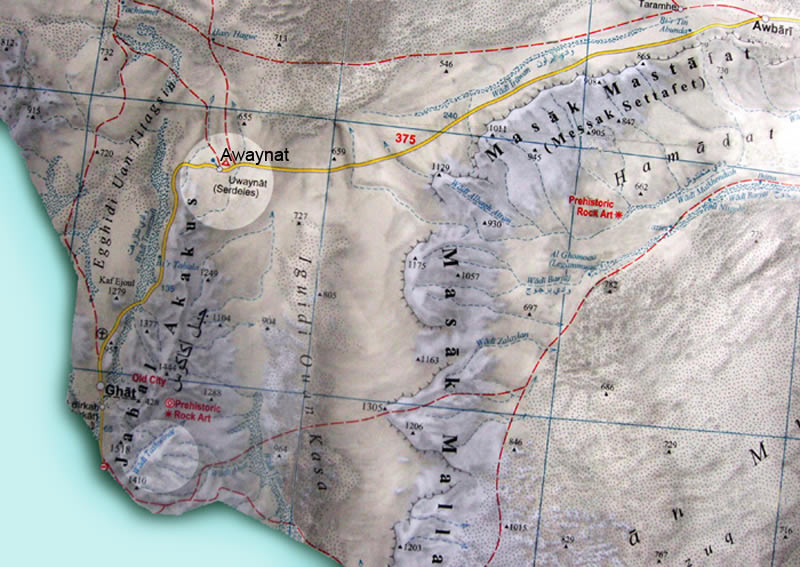
Awaynat - Acacus:
Sabha - Germa - Ubari - Awaynat - Adad - Awiss - Tin Lallen - Talwawt - Wadi Tashwinat - the home of more than 100 valleys.
Ghat - Acacus:
Ghat is too close to the Algerian border and therefore we always recommend entering Acacus via Awaynat. However, the main routes from Ghat and Tanezuft are:
Ghat > -al-Fawar (Wadi Tanezuft)
> Wadi Adar n Dzhalko
> Tissatin > Tin Lalen.
Ghat > Wadi Tanezuft
> Wadi In Aghallasham
> Tihe n Awiss Pass
> Awiss.
Acacus Route 2:
This is a classic route starts from Germa (or Tkerkiba) and heads south towards Wadi Metkhandoush, then across Wan Casa to Acacus, before ending in Ghat at the far west of the country.
Germa
>
Wadi Berjuj
>
Idhan Murzug sand dunes.
Messak Settafet > Metkhandoush > Abahoha Pass
>
Wan Casa (Kaza) sand dunes.